
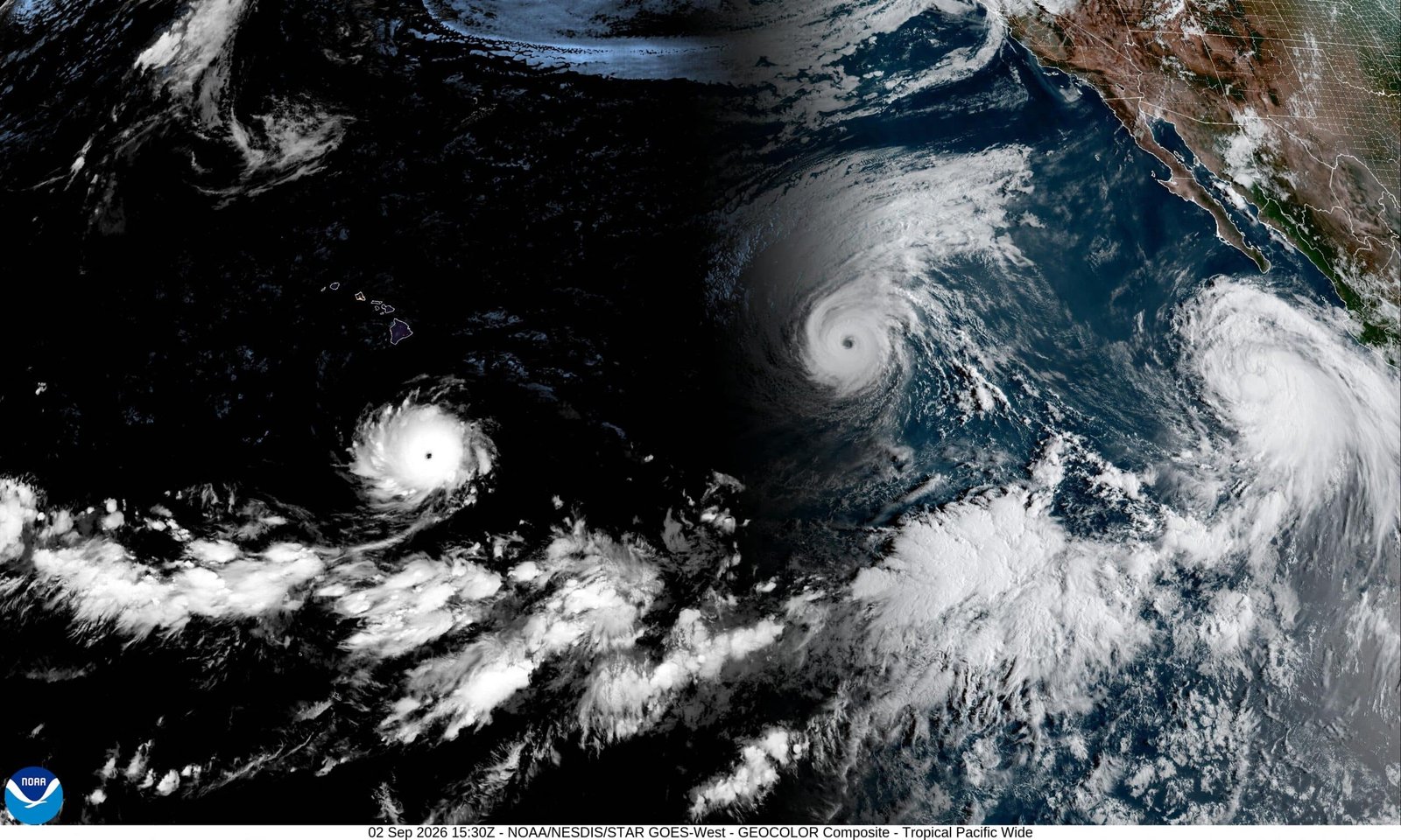
GENEVA, Sept. 5, 2026 — The World Meteorological Organization says the El Niño now developing across the tropical Pacific is expected to strengthen into a very strong event later this year, potentially reaching record intensity, while its effects could persist into early 2027. The warning matters because El Niño can reorganize rainfall and temperature patterns across continents, increasing risks of drought, flooding and extreme heat while putting additional pressure on agriculture, water supplies, shipping and food markets.
GENEVA, Sept. 5, 2026 — The World Meteorological Organization says the El Niño now developing across the tropical Pacific is expected to strengthen into a very strong event later this year, potentially reaching record intensity, while its effects could persist into early 2027. The warning matters because El Niño can reorganize rainfall and temperature patterns across continents, increasing risks of drought, flooding and extreme heat while putting additional pressure on agriculture, water supplies, shipping and food markets.
The latest WMO update, issued Sept. 3, said there is a near-100% probability that El Niño will persist through February 2027. The agency said the tropical Pacific is exceptionally warm and that the event is expected to peak toward the end of 2026.
The warning comes as countries in Asia, Latin America and elsewhere are already reporting weather disruptions associated with the developing event.
El Niño is strengthening rapidly
El Niño is a recurring ocean-atmosphere phenomenon in which unusually warm surface waters develop across the central and eastern equatorial Pacific. The resulting changes in atmospheric circulation can alter storm tracks and rainfall far beyond the Pacific.
The current event has strengthened sharply during 2026.
The U.S. National Oceanic and Atmospheric Administration's Climate Prediction Center said in its August assessment that there was a greater than 90% chance of a very strong El Niño during the Northern Hemisphere fall and winter of 2026-27. NOAA also estimated a 69% probability of a historic event during October-December, defined in its forecast as exceeding the strength of El Niño events dating to 1950.
That distinction is important. A record event has not yet been confirmed. NOAA's forecast is probabilistic, while WMO says the event is expected to become very strong and could reach exceptional levels.
The International Research Institute for Climate and Society likewise reported in August that most models were forecasting a very strong El Niño, with Niño 3.4 sea-surface temperature anomalies reaching at least 2°C above the reference average during much of late 2026 and early 2027.
Pacific heat is already affecting weather patterns
WMO forecasts for September-November 2026 show an increased likelihood of above-normal temperatures across almost all land areas, alongside rainfall patterns associated with a strong El Niño. A positive Indian Ocean Dipole is also expected to develop, while tropical Atlantic waters are forecast to remain warmer than average. WMO cautions that these additional climate signals can reinforce, weaken or alter typical El Niño effects from region to region.
The result will not be uniform global warming or universal drought. El Niño produces different regional outcomes.
Some areas may become considerably wetter, while others experience severe rainfall deficits. Heat risk can rise in multiple regions, while changes in atmospheric circulation can influence tropical storms and winter weather.
WMO Secretary-General Celeste Saulo warned that communities and economies are already experiencing disruption from drought and flooding and that risks could increase as the phenomenon intensifies.
UN Secretary-General António Guterres has also called the developing event a major climate risk, emphasizing the need for stronger preparedness and early-warning systems.
Sri Lanka and India show the human impact
The consequences are already visible in parts of South Asia.
In Sri Lanka, Reuters reported that some agricultural districts have recorded rainfall deficits of 85% to 100% below long-term averages. Water sources are drying up, farmers are losing crops and the government has arranged water deliveries for tens of thousands of people.
India is also facing growing agricultural concerns after deficient rainfall. Reuters reported that rainfall was 35% below normal in June, while August remained weak. Crops including cotton, soybean, corn and rice are at sensitive stages, making September rainfall particularly important for harvest prospects.
A prolonged rainfall shortfall could also affect India's winter planting season and increase pressure on food imports, with potential implications for domestic inflation and agricultural incomes.
Panama Canal faces another test
The El Niño threat also extends beyond agriculture.
The Panama Canal Authority has already introduced measures to manage reduced precipitation in the canal watershed. From Sept. 3, daily transit capacity at the Neopanamax locks was adjusted to nine slots, while Panamax capacity was also reduced; further changes were scheduled for Sept. 15. The authority cited below-expected precipitation and the need to protect the water supply supporting canal operations.
The canal is a critical link between Atlantic and Pacific shipping routes. Water shortages can therefore create consequences well beyond Panama, potentially affecting vessel scheduling, cargo logistics and international supply chains.
The canal authority has been preparing for the risk since late 2025 and says it has implemented water-saving measures while monitoring conditions closely.
Food markets are another pressure point
El Niño can disrupt food production because its rainfall and temperature effects occur across several major agricultural regions simultaneously.
Global food markets were already under pressure in August. The U.N. Food and Agriculture Organization said its Food Price Index rose to 133.3, the highest level since late 2022, with cereal, vegetable-oil, sugar, meat and dairy prices all increasing. The organization also reduced its 2026 global cereal production forecast. Weather was one of several factors behind the deterioration, alongside geopolitical and trade disruptions.
That does not mean El Niño alone caused the rise in global food prices. Supply chains are also being affected by geopolitical conflicts, trade restrictions and regional production problems.
But a stronger El Niño could add another layer of volatility to commodities already facing tight supply conditions.
Climate change adds another layer of risk
El Niño itself is a natural climate phenomenon, not a direct consequence of human-caused climate change.
However, its effects occur against a much warmer global climate and exceptionally warm oceans. That background warming can raise the baseline on which El Niño-driven heat and weather extremes occur.
WMO has emphasized that the combination of El Niño with other climate factors can significantly alter regional impacts. Its forecasts therefore focus not only on the Pacific anomaly itself but on the wider atmospheric and oceanic system.
The question of whether climate change is making individual El Niño events intrinsically stronger is more complex than simply attributing the current event to global warming. Scientists continue to study that relationship.
What happens next
The critical period will be the coming months.
WMO expects El Niño to strengthen toward a very strong intensity and peak near the end of 2026, with impacts continuing into 2027. NOAA's latest assessment similarly points to continued strengthening through the end of the year.
The key question is whether the event ultimately exceeds previous benchmark El Niños in the standardized measurements used by climate agencies.
For governments, businesses and humanitarian organizations, however, waiting for a record to be confirmed would miss the practical issue. The forecasts already indicate an elevated probability of disruptive weather.
Agricultural planners, water managers, shipping companies, disaster agencies and public-health authorities are therefore entering the final months of 2026 with a clear signal: prepare for unusually large swings in heat and rainfall, even though the precise regional outcome will vary.
WMO has called for expanded early-warning and preparedness measures, while national meteorological agencies continue updating forecasts as the Pacific event evolves.
The strongest El Niño ever recorded is not yet a settled fact. But the probability of a historically intense event has become high enough that governments and markets are already responding to the risk.
FAQ
What is El Niño in 2026?
El Niño is a natural ocean-atmosphere climate phenomenon involving unusually warm waters in the central and eastern tropical Pacific. The 2026 event is strengthening rapidly and is forecast to become very strong.
Could the 2026 El Niño be the strongest ever recorded?
Yes, it could. NOAA's August outlook gave a 69% chance of a historic event exceeding its benchmark for El Niño strength since 1950, while WMO says the event could reach exceptional intensity.
How long will the 2026 El Niño last?
WMO forecasts a near-100% likelihood that El Niño will persist through February 2027. Its climate effects can continue even after the ocean event itself begins to weaken.
Which countries could be affected by the extreme El Niño?
Impacts can occur across much of the world. Current concerns include drought and agricultural stress in parts of South Asia, rainfall disruption in Latin America, water pressure around the Panama Canal and changing temperature and rainfall patterns across many other regions.
Will El Niño make the whole world hotter?
Not necessarily. El Niño changes global atmospheric circulation and can produce warmer conditions in many regions while causing cooler or wetter conditions elsewhere. WMO forecasts above-normal temperatures across almost all land areas for September-November 2026, but regional rainfall effects will vary.
Could El Niño increase food prices?
It could add pressure to food markets by damaging crops or reducing yields in affected regions. However, food prices also depend on geopolitical events, trade, inventories, energy costs and other weather conditions.
Is climate change causing this El Niño?
El Niño is a naturally occurring climate phenomenon. Scientists distinguish the natural El Niño cycle from the broader influence of human-caused global warming, which raises the overall temperature baseline and can intensify the consequences of climate extremes.
Why is the Panama Canal concerned about El Niño?
The Panama Canal relies on freshwater from its watershed to operate its locks. Reduced rainfall associated with El Niño can lower water availability and force the canal authority to adjust shipping capacity.
KEY TAKEAWAYS
- WMO expects El Niño to become very strong, potentially reaching exceptional levels toward the end of 2026.
- NOAA puts the probability of a historic-strength event at 69% for October-December 2026 under its defined benchmark.
- WMO sees a near-100% chance of El Niño persisting through February 2027.
- South Asia is already experiencing serious rainfall and agricultural disruption, particularly in Sri Lanka and India.
- The Panama Canal is adjusting operations amid reduced watershed precipitation.
- The event could increase pressure on food markets, water supplies, supply chains and disaster-response systems.